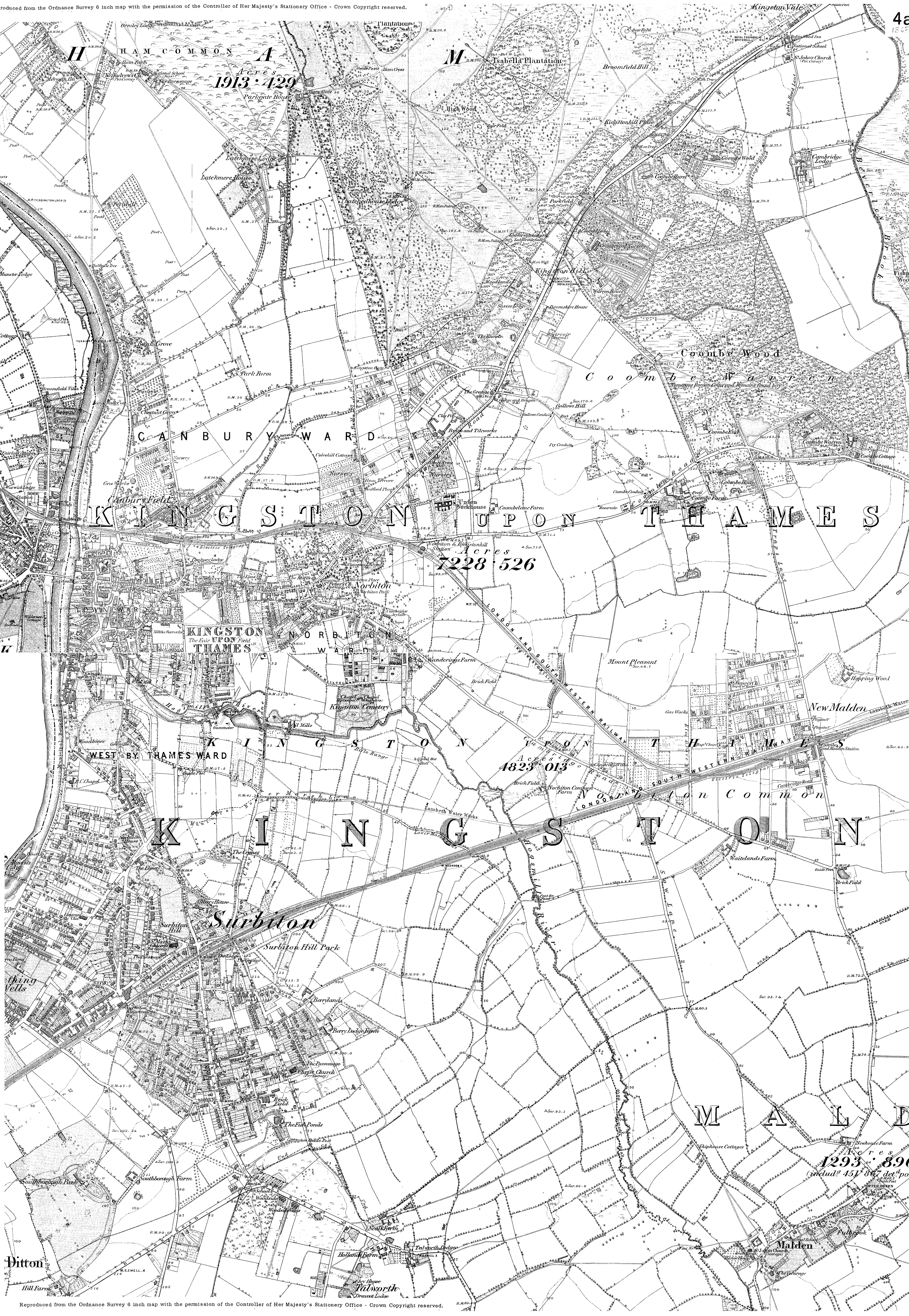
Ordnance Survey 1865
The map is a composite of two maps and as such they don't exactly join up but nothing has been lost/cut off. It is interesting to note that 'New Malden' is clearly the Groves area, north of the railway. What is also interesting is that, at the site of the gallows indicated on Rocque's Map, there is a now house called "The Knowle". This takes us back to the small raised hillock which Rocque indicated. I wonder if the occupants of The Knowle knew what was there before.
| 1865_new_malden_composite.jpg |
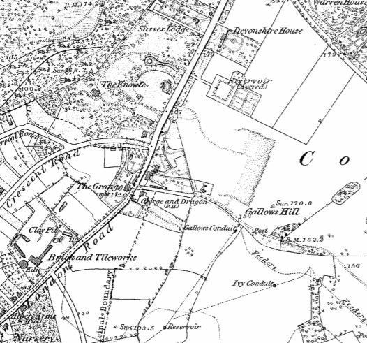
Compare the location of the gallows on Rocque's map and The Knowle on this detail.